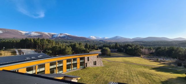
En-suite bedrooms from £60pn. Book your course and then call us to book your accommodation
Find Out MoreOverview
Do you wish you had the confidence to head out for a day hill walking, happy in your map reading and navigation abilities? This one day course will help you learn the fundamental skills of navigation, map setting, interpreting scales, contours and how to keep track of where you are. We use a range of maps and fun exercises to demystify the subject and build confidence. This one day course can be combined with the one-day Mountain Navigation course to provide you with the skills and confidence to head out independently and not rely on others.

DETAILED INFO
AIMS
Every day is slightly different depending on the weather conditions and the group aspirations, but we will cover all the core techniques required for confident mountain and hill navigation in summer conditions
PRE-REQUISITES
Fitness for a day of hill walking. No previous mountain or navigation experience, although experience of some summer hill walking and being familiar with an Ordnance Survey map would be useful.
IS IT FOR ME?
There is no need for any previous mountain or navigation experience, although experience of some summer hill walking and being familiar with an Ordnance Survey map would be useful. Using a map and compass and the associated skills of navigation in the hills are our main focus
CONTENT
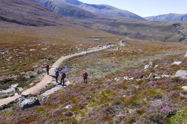
The day is usually spent around the Glenmore Lodge grounds and the local area where we can use a variety of maps and build up the basics of map setting, following a route and introducing the compass.
Initially, using a map scale of 1 cm to 50m we can provide a fun and rapid learning experience with lots of opportunity for practice without the worry of the elements and hazards of the hills.
Effective use of the compass requires other skills such as taking bearings, learning about pacing and timings to help you keep track of your progress and also relocation skills for when you are uncertain of your location.
Route planning, from guidebooks, maps and taking into account information about the weather and how fast you walk should help you to make sound decisions when planning your hill days. Understanding the weather forecast and interpreting its influence on your journey is often key to enjoying a day in the hills, so we incorporate this into the planning of the day.
Our one day course start at 09.00, if you could aim to arrive by 0830 so teaching time is not lost. Packed Lunches will need to be collected, flasks can be filled in our dining room and stores will be open from 08.30. The day will finish around 16.30 – 17.00 with a review of the day and tea and cake.
DATES & PRICES
| 2024 | ||||
|---|---|---|---|---|
| COURSE DATE | COST (with accommodation) |
COST (no accommodation) |
PLACES | BOOKING |
| Date27/07/24 | Cost (with accommodation)Call Us – Prices from £60pn | Cost (no accommodation)£105.00 | Places | |
| Date10/08/24 | Cost (with accommodation)Call Us – Prices from £60pn | Cost (no accommodation)£105.00 | Places | |
| Date24/08/24 | Cost (with accommodation)Call Us – Prices from £60pn | Cost (no accommodation)£105.00 | Places | |
| Date07/09/24 | Cost (with accommodation)Call Us – Prices from £60pn | Cost (no accommodation)£105.00 | Places | |
| Date21/09/24 | Cost (with accommodation)Call Us – Prices from £60pn | Cost (no accommodation)£105.00 | Places | |
| Date05/10/24 | Cost (with accommodation)Call Us – Prices from £60pn | Cost (no accommodation)£105.00 | Places | |
| Date09/11/24 | Cost (with accommodation)Call Us – Prices from £60pn | Cost (no accommodation)£105.00 | Places | |
| Date30/11/24 | Cost (with accommodation)Call Us – Prices from £60pn | Cost (no accommodation)£105.00 | Places | |
| Need a different date? Call 01479 861 256 to arrange your own date, or email [email protected] | ||||
| 2025 | ||||
| COURSE DATE | COST (with accommodation) |
COST (no accommodation) |
PLACES | BOOKING |
| Date29/03/25 | Cost (with accommodation)Call Us – Prices from £60pn | Cost (no accommodation)£105.00 | Places | |
| Date02/04/25 | Cost (with accommodation)Call Us – Prices from £60pn | Cost (no accommodation)£105.00 | Places | |
| Need a different date? Call 01479 861 256 to arrange your own date, or email [email protected] | ||||
Media Gallery
USEFUL INFORMATION
WHAT'S INCLUDED?
Instruction
Use of kit
Packed lunch and afternoon tea each day
In-course transport
WHAT'S INCLUDED IF YOU CHOOSE THE RESIDENTIAL OPTION - AS ABOVE PLUS
Bed in en-suite room – available from 3pm on day before your course starts
Breakfast on each course day (except for one day and back to back courses)
Dinner on each course day (except for the final day, one day or back to back courses)
Use of the facilities at Glenmore Lodge
Linen is provided along with a towel
Client REVIEWS
NEED TO KNOW
WHAT WILL I NEED
Glenmore Lodge has a large, and very comprehensive store of up to date clothing and equipment. You are welcome to borrow from our stores, at no extra cost to your course.
YOU WILL NEED (Glenmore Lodge can provide if required)
- Waterproof jacket and trousers
- Insulated synthetic jacket
- Appropriate footwear for the attended course
- A small day pack
EQUIPMENT YOU NEED TO BRING WHICH WE DO NOT HAVE IN THE STORES
Items listed here are recommended, this is not an exhaustive list.
- Warm outdoor wear
- Insulating layers
- Trekking / climbing trousers (not cotton)
- Hat & gloves
- Whistle
- Compass – Silva type 4 recommended with a 1:40,000 romer ***
- Waterproof map case
- Rucksack liner (or sturdy bin liner) / dry bags
- Hydration system (water bottle) ***
- Box or bag for packed lunch
- Personal first aid kit
- Personal toiletries & medications (towels are provided)
- Suncream & sun hat
Map information – we encourage everyone on mountain courses to have a map covering the Northern Cairngorms with a 10km radius from the ski area. There are a range of scales and maps available OS 1:50,000, OS 1:25,000 and Harvey Map 1:40,000. The OS 1:50,000 map sheet 36 covers the widest area, but the Harvey 1:40,000 has a lot of additional information on the back of it, however it is useful to have the Silva Mark 4 compass with the 1:40,000 scale on it.
If you have digital mapping and can print off map sheets a suggested area would be:
NW corner NH8514 NE corner NJ0314
SW corner NN8593 SE corner NO0393

