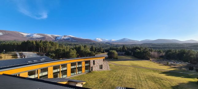
En-suite bedrooms from £60pn. Book your course and then call us to book your accommodation
Find Out MoreOverview
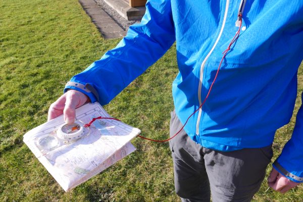
This NNAS course will provide a structured approach and progressions for teaching navigation. It will enable participants to better analyse and support their students through the learning process using a range of maps, environments, games and exercises indoors and outdoors. Teaching navigation and map reading skills from map setting, pacing, timing, contours and interpreting ground shape to, a progression of compass skills, route choice strategies and relocation skills will all be covered. By the end of the day you should have a useful toolbox of ideas and be able to create a structured programme of sessions which should to help manage time and resources for those teaching young people for DofE etc. Hopefully it will offer some personal navigation coaching as well.
This is a non-residential course.

DETAILED INFO
AIMS
This course will provide a range of practical and fun ideas to support a progressive system of teaching navigation skills.
PRE-REQUISITES
There is no special fitness level required, but we will be going over rough ground in order to look at navigation skills using contour features. You should be able to use a map and compass as whilst there may be some opportunities for personal coaching that is not the focus of the day.
IS IT FOR ME?
How do you get away from teaching grid references in the class room on a 1:50,000 scale map. We want to help you move from map reading skills to navigation skills without having to necessarily get in a bus and drive to the hills to teach to the basics. This 1 day course is aimed at teachers, youth workers, outdoor instructors and anyone else interested in, or currently teaching navigation skills. This course would complement skills learnt on an ML or Hill and Moorland training course.
CONTENT
National Navigation Award Scheme (NNAS) Tutor Award Course
A one day course for those who teach navigation. It is a recognition that just because one can personally navigate it doesn’t follow that one can teach it!
Most navigation teaching in the UK is based on the old 1936 military and Ordnance Survey system of static map reading skills as opposed to the move navigation skills which recreational outdoor people need. This NNAS course has refreshing and completely different approach to teaching the subject and uses some orienteering coaching as a basis for teaching navigation for the general walker, DofE groups, Scouts and Girl Guides etc.
The day will provide a toolbox of progressions and ideas for teaching navigation from basic map setting through to using the compass. Many participants, including well qualified and experienced outdoor instructors delivering Mountain Leadership courses, have found the process valuable and their own navigation skills have benefitted from the day.
The course is a mixture of indoor and outdoor practical sessions and offers the opportunity for candidates to discuss their own methodology as well as learning new techniques from others. This is not a hill based course, we rarely walk more than 500m from the centre.
Completion of the course will provide registration with NNAS as a tutor for the NNAS Bronze and Silver awards. Currently a further one day workshop is required to deliver the Gold award. Successful completion of the NNAS Tutor Award enables those without a higher hill or mountain walking qualification but with experience and interest in the outdoors to help teach on a Bronze award under the guidance of a registered NNAS Bronze provider.
Over the next three years (from November 2016) all current award providers and their staff will have to attend this CPD-accredited course in order to continue to offer bronze-level NNAS courses.
Using some coaching ideas from orienteering as well as traditional methods we will work through a series of skills which lead the student through a solid progression of learning from map setting to map reading, contours, and starting to using a compass.
By using maps with a scale of 1:5,000 or 1:10,000 and breaking skills down into smaller parts with games or exercises we hope to be able to provide you with a tool box of ideas to liven up your teaching and enthuse the students.
We will also take a quick look at how to make a small map of your local grounds / school so you can use the tool box without having to necessarily use transport to get to a more remote teaching environment. A surprising amount of the basics of good navigation can be taught outside even in an urban environment.
This one day course starts at 09.00, if you could aim to arrive by 08.30 so teaching time is not lost. Packed Lunches will need to be collected and stores will be open from 08.30. The day will finish around 16.30 – 17.00 with a review of the day and tea and cake.
Outdoor clothing and a compass is all that is required, all the mapping will be supplied.
DATES & PRICES
| 2024 | ||||
|---|---|---|---|---|
| COURSE DATE | COST (with accommodation) |
COST (no accommodation) |
PLACES | BOOKING |
| Date19/10/24 | Cost (with accommodation)Call Us – Prices from £60pn | Cost (no accommodation)£105.00 | Places | |
| Need a different date? Call 01479 861 256 to arrange your own date, or email [email protected] | ||||
| 2025 | ||||
| COURSE DATE | COST (with accommodation) |
COST (no accommodation) |
PLACES | BOOKING |
| Date14/06/25 | Cost (with accommodation)Call Us – Prices from £60pn | Cost (no accommodation)£110.00 | Places | |
| Date18/10/25 | Cost (with accommodation)Call Us – Prices from £60pn | Cost (no accommodation)£110.00 | Places | |
| Need a different date? Call 01479 861 256 to arrange your own date, or email [email protected] | ||||
USEFUL INFORMATION
WHAT'S INCLUDED?
Instruction
Use of kit
Packed lunch and afternoon tea
In-course transport
NEED TO KNOW
WHAT WILL I NEED
Glenmore Lodge has a large, and very comprehensive store of up to date clothing and equipment. You are welcome to use your own equipment and pick and choose odd items from the store. Your instructor will want to check that personal equipment is appropriate for the activity.
GLENMORE LODGE CAN SUPPLY:
Waterproof jackets and trousers
Leather Boots
Gaiters
Day Sac
Equipment you need to bring which we do not have in stores:
Listed here are the essentials, this is not an exhaustive list.
Warm outdoor wear
Insulating layers – at least one mid weight and one warm fleece layer
General trekking trousers are recommended, not jeans though.
Thick socks (several pairs)
Spare fleece/insulated jacket
Hat & gloves***
Whistle Compass – Silva type 4 recommended ***
Rucksack liner (or sturdy bin liner) / dry bags
Flask & Water Bottle ***
Box or bag for packed lunch.
Blister kit/ small first aid kit
Suncream – you just never know! ***
Map information – we encourage everyone on mountain courses to have a map covering the Northern Cairngorms with a 10km radius from the ski area. There are now a range of scales and maps available OS 1:50,000, OS 1:25,000 and Harvey Map 1:40,000. For candidates on any NGB course such as Mountain Leader summer, you should have a 1:50,000 map and ideally one other scale. For non qualification courses any scale is fine, OS 1:50,000 map sheet 36 covers the widest area, but the Harvey 1:40,000 has a lot of additional information on the back of it, however it is useful to have the Silva Mark 4 compass with the 1:40,000 scale on it, (only available since 2010). If you have digital mapping and can print off map sheets a suggested area would be: NW corner NH8514 NE corner NJ0314 SW corner NN8593 SE corner NO0393 That will be about 4 sheets of A4 if you use the 1:50,000 scale. From time to time we will use other areas outside the northern Cairngorms in which case we will supply appropriate mapping. All maps need to be in a waterproof case. Maps and map cases are not a stores item but can be purchased from our shop.
Items marked *** are available in our shop subject to availability.

